Kangchenjunga Itinerary - North and South Base Camps, October 2004
After he had climbed Kangchenjunga from the north-west with Doug Scott and Joe Tasker in 1979, the late Peter Boardman commented to a friend that the walk to the base of the mountain had been the most beautiful he had undertaken. With the opening of the far northeast of Nepal to trekkers in 1988, I too yearned to discover that the trek to Kangchenjunga is a strong contender for the title of ‘The Most Beautiful Walk in the World’.
Crew: Guide: Gyan Prasad Tamang - same guide from the previous two years (Annapurna North Base Camp and Manaslu). He brought three of his relatives: Cook: Nima (Tibetan for Sunday) Dorje Tamang 23 years old, Porter: Pemba Rinjii Tamang 18 years old in grade 9, Porter: Suba Sing Tamang, Porter: Purna I think he is 43 years old. He has five children.
Here is my actual itinerary. The time shown are the actual trekking times and do not include lunch stops.
Oct 10 Arrive at Kathmandu
I checked into the Hotel Garuda and then took a taxi to Boudhanath. Back at the hotel, I met Gyan and paid him the rest of the money. The rest of our crew are already at Suketar, waiting for us.
Oct 11 Day 1 Flew from Kathmandu to Biratnagar (70m)
I took the early morning mountain flight and had great views of Everest, Makalu, Cho Oyu and Shishapangma. In the afternoon Gyan and I flew to Biratnagar.
Oct 12 Day 2 Biratnagar
We were supposed to fly today by Royal Nepal Airways to Suketar, but the flight was canceled. We went to their office and they rescheduled us for tomorrow. Stuck in Biratnagar.
Oct 13 Day 3 Drove from Biratnagar to Basantpur (2200m). 6:00.
Royal Nepal Airways flight was canceled for the second day in a row. Gyan found out that It isn't that the weather was bad, it was simply that they decided not to service that route. Their planes were elsewhere. B@$t@rd$! Now I'm extra worried, what if it's canceled again tomorrow. I discuss our options with Gyan, and decide not to test Royal Nepal Airways again. We take a rickshaw to the centre of town, and negotiate a 4-wheel drive to Basantpur. The paved road leaves the Terai behind and climbs up and down hills. After Hille, the paved road ends and the rutted cow path begins. Just before the sun goes down, I have an unexpected sight as we round a hill and see Makalu. We finally arrived at Basantpur and checked-in to the pleasant Yak Hotel.
Oct 14 Day 4 Trek from Basantpur to Chauki (2680m) to Buje Deoralli (2820m) to Gurja (2000m). 32km, 10:05, 1210m ascent, 1410 descent.
Gyan hired another porter, an older man named Purna, because we're a few days behind and will need to trek farther each day. Some trekking days are just hard work and this was one of them. We hiked all day from sunrise to sunset from Basantpur (2200m) to Gurja (2000m), climbing up 1210m and descending 1410m along the way. Just four hours from the Nepal Army heavily fortified town of Basantpur, a Maoist stopped us in Manglebari, and I had to pay a Maoist government tax.
Oct 15 Day 5: Gurja (2000m) to Doban (640m) to Mitlung (880m). 12km, 8:10, 240m ascent, 1360m descent.
Our second day trekking was even tougher than the first, descending 1360m from Gurja (2000m) to Doban (640m), where I met the rest of our crew. We then bushwhacked our way in blazing heat, along a new temporary trail by the river, to Mitlung (880m). I drank all of my water in just over an hour and was deliriously dehydrated for the next four hours. When I got to Mitlung, I drank a litre of Pepsi.
Oct 16 Day 6: Mitlung (880m) to Chirwa (1190m) to Sakathum (1640m). 22km, 7:20, 760m ascent, 0m descent.
The sun finally came out, and it was an enjoyable trekking day. After laundry duties, I sat inside the campsite building and watched the teenage daughter of the owner take a large pot of the wood stove, stir it with a paddle and then pour it out onto a straw mat. Gyan told me this was the first step in making chang, the powerful fermented barley ‘beer’.
Oct 17 Day 7: Sakathum (1640m) to Amjilassa (2490m) to Gyapra (2730m). 17km, 6:50, 1230m ascent, 0m descent.
Merciless! Climb 100m only to descend 80. Climb 200m only to descend 150. The so-called flat parts were even up and down. The good news was that the old vertigo-inducing trail has been replaced with a new normal trail. At least Gyapra is at a higher altitude and the weather is not so hot. I thoroughly enjoy my Coke (and later my dinner) inside the kitchen enjoying the banter of the various porters, guides and the local Tibetan family.
Oct 18 Day 8: Gyapra (2730m) to Ghunsa (3410m) to Kambachen (4150m). 21km, 7:20, 1420m ascent, 0m descent.
Easy! Just a gentle uphill at the rate of the river - no ups and downs. With a new trail along the same side of the river, we arrived in Phole (3210m) 20 minutes ahead of schedule. I visited the Tashi Chombel Gompa in Phole, which houses one of four Buddha Maitreya statues that dates back to the eight century. We finally arrived in Ghunsa (3410m), the main village of the valley, and what I consider to be the start of the trek - the work is over, and the pleasure begins.
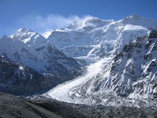
The trek from Ghunsa was a little hard because my reflexes were a little off due to the increasing altitude. As we neared the huge active landslide with potential rock-fall danger, Jannu came into view. I crossed the landslide without incident and then the clouds lifted completely off Jannu. We camped at Kambachen (4150m), a Tibetan settlement of about a dozen houses. Only the upper portion of Jannu is visible from Kambachen, so I walked back about 20 minutes to take some photos.
Oct 19 Day 8: Kambachen (4150m) to Lhonak (4790m) to Pangpema (5140m). 20km, 6:25, 1000m ascent, 0m descent.
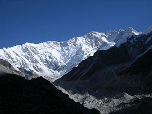
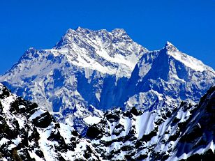
I struggled again today as I slowly acclimatized to the ever higher altitudes. From the far east of Ramtang, in a gap with Wedge Peak, the Kangchenjunga main summit (8586m, far left), the west summit Yalung Kang (8505m, just right of main), and Kambachen (7903m, upper right) are a welcome surprise. We stopped for lunch at the yak pasture of Lhonak for lunch. Although Kangchenjunga is not visible from Lhonak, Tent Peak (7365m) and Nepal peak (7168m) are best seen from Lhonak, not Pangpema.
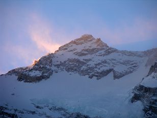
Two and a half hours from Lhonak, we arrive at Pang Pema (5140m), with one of the most magnificent mountain vistas in the world with glaciers, The Twins, Kangchenjunga and Wedge Peak. Pangpema was used as the base campsite for Dyhrenfurth’s 1930 expedition, the low rock walls which stand today having been built at that time. In 1979 Joe Tasker described it as “a windswept shelf of grass-poised above Kangchenjunga glacier.” Doug Scott said it was “a good place, with lots of blue sheep, birds on their winter plumage and lammergeyer higher up.”
Oct 20 Day 9: Pangpema (5140m) to Lhonak (4790m) to Kambachen (4150m). 20km, 4:30, 0m ascent, 1000m descent.
I washed my socks and underwear yesterday. When I got up this morning, I could use them as a weapon - they were frozen. It was -5C in my tent and -9C outside Just after sunrise, we climbed a very steep 230m hill directly behind Pangpema to get a more complete view. In fact, the only extra things you can see are Kambachen and a little more of the Kangchenjunga Glacier. So, it is not necessary. We then trekked back to Kambachen for the night.
Oct 21 Day 10: Kambachen (4150m) to Ghunsa (3410m) to Sele La camp (4290m). 17km, 6:15, 880m ascent, 740m descent.
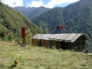
This was another work transit day as we trekked down from Kambachen back to Ghunsa. The trek up to the Sele La was, eh, short and straight up. Sele La camp (4290m) is situated in an idyllic setting with a few permanent and a few temporary huts, and a placid stream flowing through, disappearing down valley.
Oct 22 Day 11: Sele La camp (4290m) to Ramche (4620m). 17km, 7:15, 1060m ascent, 850m descent.
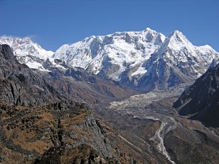
As we ascended towards the Sinion La (4663m), Jannu's magnificent southwest face started to appear more and more above the intervening ridge. We then crossed the Mirgin La (4660m) and an Unnamed Pass (4724m) before starting our descent to the Yalung valley. Just below the last pass, we had a magnificent view of the Yalung valley with Kangchenjunga, Talung, Kabru, and Ratong rising above the Yalung Glacier. We then trekked up the valley to Ramche, the uppermost yak grazing pasture in the Yalung’s ablation valley.
Oct 23 Day 12: Ramche (4620m) to Oktang (4800m) to Torontan (2990m). 27km, 6:00, 180m ascent, 1810m descent.
We left just at sunrise in cold -17C clear weather and reached Oktang, a chorten topped with prayer flags, in just under an hour and a half. There at the head of the valley is the magnificent southwest face of Kangchenjunga. We saw blue sheep as we trekked back to Ramche for breakfast.
The holiday is now over. The rest is just part of getting home. We trekked directly back to Torontan, just beating an afternoon shower.
Oct 24 Day 13: Torontan (2990m) to Omji Khola (2340m) to Yamphudin (1690m). 15km, 5:40, 730m ascent, 2030m descent.
We quickly trekked in ever hotter weather downhill to Omji Khola, where we had a quick lunch. Gyan spoke to the man who ran the campground, and arranged for us to stay at his house in Yamphudin.
As we ascended to the saddle of Lamite Bhanjyang (3410m), I had to cross three recent very dangerous landslides, where one misstep or trip would kill me. I was literally on my hands and feet on most of it, always leaning in to the hillside. The trek downhill to Yamphudin was extremely fast and pleasant because the local villagers maintain the trail, adding many rock steps to ease the way.
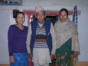
The stay at the Yamphudin private house was one of the highlights of the trek, arriving on a special day, a large Hindu festival called Dasain. The grandfather of the house is an elder of the village, and the local villagers come to his son's house to have him apply tikka. The mother of the house invited our group to join them in a small party. She put a ceremonial katta scarf around each of our necks, and gave us our favourite drink. There were about 30 people there, including babies, children, teenagers and us older people. A teenager with a ghetto blaster played Nepali music, and people danced in ones, twos or threes.
Oct 25 Day 14: Yamphudin (1690m) to Yangpang (1720m) to Sinchewa Bhanjyang (2240m), 16km, 7:30, 940m ascent, 420m descent.
Another hard day as the weather is getting hotter and hotter.
Oct 26 Day 15: Sinchewa Bhanjyang (2240m) to Pokara (1940m) to Suketar (2400m). 12km, 5:30, 1150m ascent, 990m descent.
What a tough last day on my Kangchenjunga trek. After descending 810m from Sinchewa Bhanjyang, we crossed a stream and then it was uphill 1150m to the top of the ridge. At last it was easy, descending to Suketar (2400m). Suketar is heavily guarded by the military and police. The Maoists are never far away. We celebrated our successful trek with our first alcohol of the trek. I gave the crew their tips.
Oct 27 Day 16: Suketar (2400m) to Biratnagar to Kathmandu by Yeti Airlines
I awoke to my last view of Kangchenjunga in the early morning sun before it started to cloud over. Gyan and I flew with Yeti Airlines via Biratnagar to Kathmandu. I had a few hours for some shopping and then I was at the airport again for my flight out.
Kanchenjunga Nepal