Mountains Of Travel Photos
Home | Gasherbrum IV References | Contact 

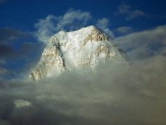
The West Face of Gasherbrum IV shines at sunset from Goro II. The first ascent of Gasherbrum IV was made via the northeast ridge on August 6, 1958 by famed Italian mountaineer Walter Bonatti and Carlo Mauri on a strong Italian team led by legendary climber Riccardo Cassin. ‘A desperate struggle between the mountain and ourselves, but we were all winners, and at 12.30 exactly the little pennants of Italy, Pakistan and the C.A.I. fluttered on the Summit itself. Fluttered – no, blew out in the howling gale.’ - Karakoram: The Ascent Of Gasherbrum IV by Fosco Maraini.

The West Face of Gasherbrum IV shines at sunset from Goro II. (click to enlarge)


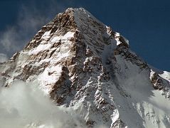
The K2 West Face shines in the late afternoon sun from Concordia. The K2 West Ridge is on the far left. The Southwest Pillar separates the sunny west face from the K2 South Face. The Great Serac is just in shadow to the right below the K2 Summit. The K2 Shoulder is farther down to the right, partially in the sun. The K2 West Ridge was first climbed by Japanese Eiho Otani and Pakistani Nazir Sabir, reaching the K2 summit on August 7, 1981.

K2 West Face from Concordia with K2 West Ridge on left, the Southwest Pillar, the South Face, the Great Serac, and the K2 Shoulder. (click to enlarge)


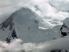
The next morning we started our trek from Shagring Camp to Gasherbrum Base Camp in mostly cloudy weather. After 30 minutes we reached ‘Gasherbrum Corner’ at the junction of the Upper Baltoro Glacier with the tributary Abruzzi Glacier. Gasherbrum I and Gasherbrum I South lie straight ahead. Gasherbrum I (8080m) is the 11th highest mountain in the world. Gasherbrum I was first climbed by July 5, 1958 by Americans Pete Schoening and Andy Kauffman. Gasherbrum I South (7069m) was first climbed by Maurice Barrard and Georges Narbaud via the Southwest Ridge in July 1980 on their ascent of Gasherbrum I

Gasherbrum I and Gasherbrum I South from the junction of Upper Baltoro Glacier and the Abruzzi Glacier (click to enlarge)


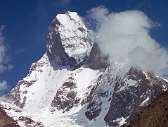
Taken from the upper Baltoro Glacier, the twin summits of Muztagh Tower (7274m) are perfectly aligned and the mountain is seen as a slender tooth, looking impregnable. A similar photo by Vittorio Sella in 1909 inspired two expeditions to race for the first ascent in 1956. In reality both teams found their routes less steep than Sella's view had suggested. Joe Brown and Ian McNaught-Davis climbed from the west side of the peak and reached the west summit of Muztagh Tower (7270m) on July 6, 1956. Tom Patey and John Hartog repeated the ascent the next day, also reaching the slightly higher east summit (7274m). A few days later a French Team of Guido Magnone, Robert Paragot, André Contamine, and Paul Keller climbed the mountain from the east.

Taken from the upper Baltoro Glacier, the twin summits of Muztagh Tower (7274m) are perfectly aligned and the mountain is seen as a slender tooth, looking impregnable. (click to enlarge)


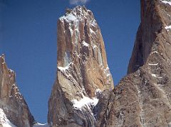
The Trango Tower (6239 m), commonly called Nameless Tower, is a very large, pointed spire which juts 1000m out of the ridgeline. The Trango Monk (5850m) is to the left. The Trango Nameless Tower was first climbed in 1976 with Mo Anthoine, Martin Boysen reaching the summit on July 8, 1976 and Joe Brown and Malcolm Howells the next day.

The Trango Nameless Tower (6239 m) is a very large, pointed spire which juts 1000m out of the ridgeline. The Trango Monk (5850m) is to the left. (click to enlarge)


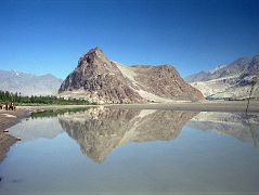
The Khardong Hill with the Kharpocho Fort is beautifully reflected in the calm Indus River in Skardu (2286m). Skardu is the district headquarters of Baltistan, situated on the banks of the mighty Indus River, just 8 km (5 miles) above its confluence with the Shigar River. The Indus barely seems to move across the immense, flat Skardu valley, 40km long, 10 km wide and carpeted with sand dunes. There are several beautiful blue lakes nearby, including Satpara, and Upper and Lower Kachura.

The Khardong Hill with the Kharpocho Fort is beautifully reflected in the calm Indus River in Skardu (2286m). (click to enlarge)


GGasherbrum II pokes out to the right of The West Face of Gasherbrum IV shining in the late afternoon sun from Concordia.

Gasherbrum II pokes out to the right of The West Face of Gasherbrum IV shining in the late afternoon sun from Concordia. (click to enlarge)


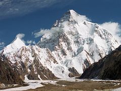
Just after leaving Concordia, I looked up the Godwin Austin Glacier as the sun finally hit the K2 West Face, with Angel Peak (Angelus Peak) coming into view on the left. The K2 Southwest Pillar separates the sunlit South Face from the West Face mostly in shadow to the left. The South-southeast Spur is now lit up by the sun and arrives at the K2 Shoulder on the right. On the far right is the Abruzzi Ridge / Spur, the East-southeast ridge, the normal ascent route.

Full view of K2 West Face and South Face from just beyond Concordia with Angel Peak on the left. (click to enlarge)


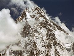
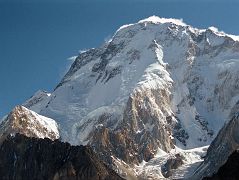
Just after leaving Concordia, the sun finally hit Broad Peak. The North Summit is on the far left, the Central Summit is slightly out of view in the middle, and on the far right is the Main Summit. The first ascent of Broad Peak North summit was made by Renato Casarotto on June 28, 1983. The first traverse of the three Broad Peak summits was completed by Jerzy Kukuczka and Wojtek Kurtyka. They climbed the west ridge to the North summit, continued along the ridge to the Central summit. The pair then descended to Broad Col from where they followed the original route over the Forepeak to the main summit on July 17, 1984.

Broad Peak just after leaving Concordia with the North Summit on the left, the Central Summit slightly out of view in the middle, and the Main Summit on the right (click to enlarge)


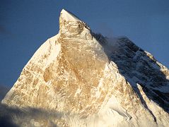
The next morning dawned clear with the first rays of the sun hitting Masherbrum with its ice cream cone top glistening in the sun from Goro II. The summit of Masherbrum's sheer north face is a perfect pyramid, with steep narrow ridges rising suddenly to a sharp pinnacle. It was first climbed via the south west face on July 6, 1960 by George Bell and Willi Unsoeld on an American - Pakistani expedition. Two few days later on July 8, expedition leader Nick Clinch and Pakistani Captain Jawed Akhter Khan also reached the summit.

Masherbrum with its ice cream cone top glistens at sunrise from Goro II. The summit is a perfect pyramid with steep narrow ridges rising suddenly to a sharp pinnacle. (click to enlarge)


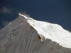
Chogolisa I (7665m) is on the left and Chogolisa II (7654m) is on the right, seen from Shagring camp on the Upper Baltoro Glacier. On August 4, 1958 a Japanese expedition organized by the Academic Alpine Club of Kyoto led by Takeo Kawabara made the first ascent of Chogolisa II, with Masao Fujihira and Kazumasa Hirai reaching the summit. The first ascent of Chogolisa I (7665m) was made on August 2, 1975 by Fred Pressl and Gustav Ammerer of an Austrian expedition led by Eduard Koblmuller. Koblmuller almost suffered the same fate as Hermann Buhl, as he also fell through a cornice on the ascent; fortunately, he was roped and team members were able to pull him to safety.

Chogolisa I (7665m) is on the left and Chogolisa II (7654m) is on the right, seen from Shagring camp on the Upper Baltoro Glacier. (click to enlarge)


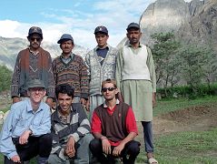
We arrive in Thongol and quickly unload the jeep and set up the kitchen tent and my tent where I rest for a few minutes. Ahhh. Iqbal puts together the loads a little bit like a jigsaw puzzle trying to even them out to 25kg each. There are nine loads so Iqbal has to find five more porters. He tells me he's having trouble because the porters want to wait for the mountaineering expedition we met on the flight to Skardu. Here is our team at Thongol: below - Jerome Ryan, guide Iqbal, cook Ali; above - porters Syed, Muhammad Khan, and Muhammad Siddiq, and finally our sirdar Ali Naqi.

Our team: Jerome Ryan, guide Iqbal, cook Ali; above - porters Syed, Muhammad Khan, and Muhammad Siddiq, and finally our sirdar Ali Naqi. (click to enlarge)

Updated: June 2011. Click on an image to see the FULL size with a caption.

Gasherbrum IV - 7925m - #17 In The World

To see the full list of photos, see K2 Photo Gallery.

Gasherbrum is a remote group of peaks located at the north-eastern end of the Baltoro Glacier in the Karakoram range of the Himalaya. The massif contains two of the world's 8000m peaks. In 1856, Thomas George Montgomerie, a British Royal Engineers lieutenant and a member of the Great Trigonometric Survey of India, sighted a group of high peaks in the Karakoram from more than 200 km away. He named five of these peaks K1, K2, K3, K4 and K5 where the K denotes Karakoram. Today, K1 is known as Masherbrum, K3 as Broad Peak, K4 as Gasherbrum IV and K5 as Gasherbrum I. Only K2, the second highest mountain in the world, has kept Montgomerie's name.

Greg Child from Thin Air: Encounters In The Himalaya

Gasherbrum is really a mutated word, transcribed from the Balti, whose name for the mountain, 'rgasha brum' means literally, 'beautiful mountain'. The modern 'Gasherbrum' was officially coined in 1860, when the British surveyor Montgomerie registered the name with the Grand Trigonometric Survey of India. When Sir William Martin Conway explored the Baltoro in 1892, he called the mountain’s west face 'The Shining Wall'. ... And right beside us, so close we feel we could touch it, stands the West Face of Gasherbrum IV, golden, steep, daunting. Seeing it awash with light, I understand why the old explorer, Conway, had called it 'The Shining Wall'.
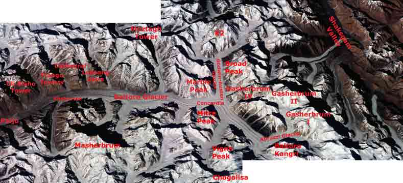


Baltoro Glacier from Paiju to Concordia with K2, Broad Peak, Gasherbrum I, Gasherbrum II and Gasherbrum IV, Masherbrum  - Nasa Image ISS001-343-26 and 343-27

Baltoro Glacier Trekking Route To Concordia And Gasherbrum Base Camp

After flying from Islamabad to Skardu with an amazing view of Nanga Parbat, driving from Skardu to Thongol, and trekking from Thongol to Paiju, I set foot on the Baltoro Glacier. I trekked to Khoburtse that first day with a stunning view of Trango Nameless Tower and the Great Trango Tower. I had a dazzling sunrise from Khoburtse with views of Paiju Peak, Uli Biaho Tower, Trango Towers, Cathedral, and Lobsang Spire. The next trekking day we went from Khoburtse to Goro II where Masherbrum was striking both at sunset and sunrise while Gasherbrum IV loomed ahead with Gasherbrum II poking out to its right.

The next day was a fairly short trekking day passing Muztagh Tower before arriving at Concordia, the highlight of the whole trek with K2 dominating the view at the head of the Godwin-Austen Glacier. Rotating in a circle at Concordia, the view has K2, Broad Peak, Gasherbrum IV, Baltoro Kangri, Vigne Peak, Mitre Peak, Paiju Peak, the spires of the Baltoro Glacier, Crystal Peak and Marble Peak. WOW! Spectacular! Breathtaking!

The next day we trekked on the Upper Baltoro Glacier to Shaqring Camp with views of Chogolisa and Baltoro Kangri. Cloudy weather rolled in as we trekked on the Abruzzi Glacier to Gasherbrum Base Camp with a brief view of Gasherbrum I. After back-tracking to Concordia it snowed, so we decided to return back down the Baltoro Glacier instead of waiting for the weather to clear and the snow to melt.
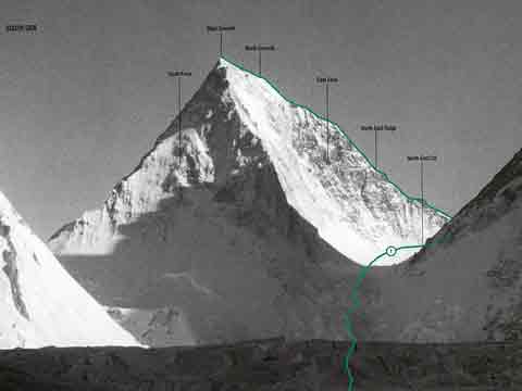
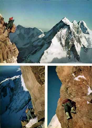
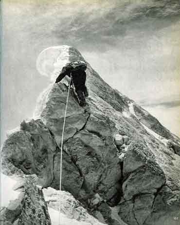
Gasherbrum IV First Ascent


Gasherbrum IV South And East Faces And First Ascent Route - World Mountaineering book

Walter Bonatti And Carlo Mauri Climb Difficult Rock Pitches High On Gasherbrum IV Northeast Ridge - Karakoram The Ascent Of Gasherbrum IV book

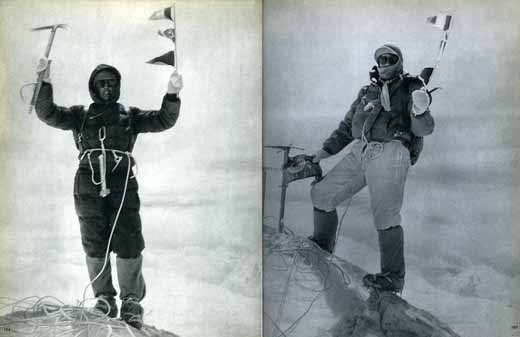
Walter Bonatti Leads The Last Few Metres To Gasherbrum IV Summit August 6, 1958 - Karakoram The Ascent Of Gasherbrum IV book

Walter Bonatti and Carlo Mauri on Gasherbrum IV Summit First Ascent August 6, 1958 - Karakoram The Ascent Of Gasherbrum IV book

The first ascent of Gasherbrum IV was completed by an Italian expedition led by Riccardo Cassin with Walter Bonatti and Carlo Mauri reaching the summit on August 6, 1958 via the very difficult and dangerous northeast ridge.

Excerpts from Karakoram: The Ascent Of Gasherbrum IV by Fosco Maraini. They climbed the steep icefall, gaining the col between Gasherbrum III and IV and stared at the northeast ridge. "The North-East Ridge, on closer acquaintance, proved to be jagged with rocks, rose-red in the light of a setting sun, with fantastic cornices of snow and blue ice-cliffs."

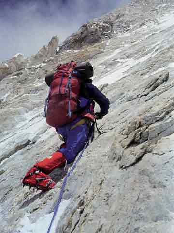
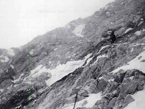
Walter Bonatti and Carlo Mauri pushed out the route and tried to conquer the northeast ridge. "One highly difficult and dangerous pitch followed another, exhausting both the physical and nervous energies of the two leading men. ... endless series of knife-edge and rock-face, cliff and overhang" They realized they needed another camp on the ridge, but the rest of the team couldn’t keep the camps stocked quickly enough so they abandoned their summit bid and descended until the supply issues could be solved.

The team set up Camp 6, and Bonatti and Mauri retraced their steps and continued to tackle the northeast ridge. The summit day commentary is mainly by Walter Bonatti. "We were on the fore-summit at ten-thirty ... Nearer and nearer came the Summit, which outlines itself in the form of a wall rising steeply to five distinct points. ... A desperate struggle between the mountain and ourselves, but we were all winners, and at 12.30 exactly the little pennants of Italy, Pakistan and the C.A.I. fluttered on the Summit itself. Fluttered – no, blew out in the howling gale. 'In spirit, the whole Expedition was with us at that solemn moment of fulfillment. We embraced each other, deeply moved.'" They descended in a blizzard, with Giuseppi de Francesch almost falling to his death at 7200m.
Other notable Gasherbrum IV ascents:


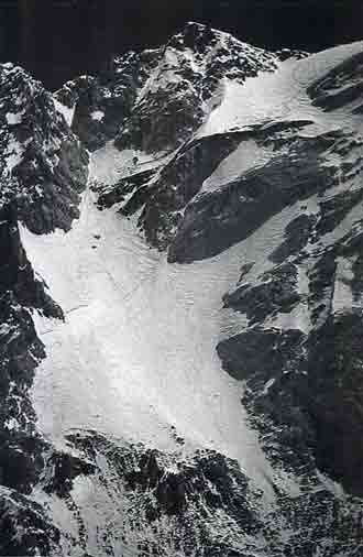
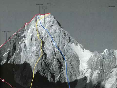
Gasherbrum IV West Face With Climbing Routes - 2. Northwest Ridge 1986, 3. West Face Central Spur 1997, 4. West Face 1985 - World Mountaineering book

Gasherbrum IV First Ascent West Face - Wojciech Voytek Kurtyka Climbing - World Mountaineering book

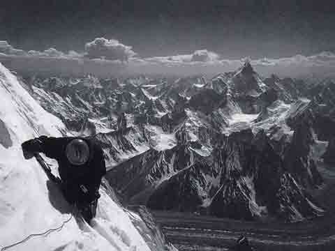
Gasherbrum IV First Ascent West Face - Robert Schauer In Deteriorating Weather On Day 3 - American Alpine Journal

Gasherbrum IV First Ascent - West Face

The 3000m high Gasherbrum IV West Face was climbed by Robert Schauer and Wojciech Kurtyka from July 13 to 20, 1985. After reaching the North Summit, bad weather and extreme exhaustion forced them to descend, missing the main summit. Their climb was selected by Climbing magazine as the greatest Himalayan climb of the 20th century. Robert Schauer in World Mountaineering:

Surviving on that face took every last ounce of our will and skill. The difficult first half took far longer than we expected, with the result that we ran out of food and fuel. Yet the summit looked within our grasp - until our plans were completely destroyed by the onset of a fierce storm. Already exhausted, we dug ourselves into a snow hole at 7700m - and remained pinned there for the next two days. We had scarcely eaten or drunk in 72 hours and, after such long deprivation, had become inured to the constant cold.

The cold was almost unbearable. When the sun reached the Wall, it took hours to penetrate our stiff bodies, while we struggled to escape the clutches of our dream world. ... Slowly our bodies began to move in the warming sun, almost like a reflex. It was clear to both of us that our only chance of salvation lay in continuing the climb. We would have to wade through thigh-deep snow towards the summit. Although less steep, we moved at a snail speed. At last, late in the afternoon, we reached the top of the face. A little nick in the ridge indicated a way to go down. We said nothing. Neither of us wanted to climb a few extra metres to the summit.

Intuitively, I nosed out the only way down across high rock steps and ice barriers. As if by magic, on a face so vertical and depressingly smooth, safe places appeared for us to stand on, and when it grew dark, we found a 'comfortable' spot to bivouac at 6500m. This was our tenth night on Gasherbrum IV. As our abseil descent became increasingly dangerous, still I believed nothing could harm us. After a whole day and night we reached the level surface of the glacier.
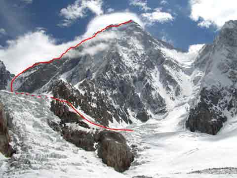
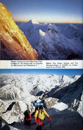
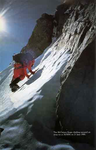
Gasherbrum IV First Ascent Northwest Ridge Route - alpinist.com

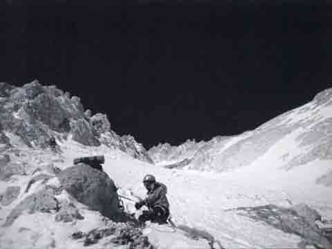
Gasherbrum IV At Sunset With Chogolisa, Tom Hargis And Tim Macartney-Snape At 7000m On Gasherbrum IV June 20, 1986 - Thin Air Encounters In The Himalaya book

Tim Macartney-Snape Climbing Unroped At 7460m On Steep Ice On Gasherbrum IV June 21, 1986 - Thin Air Encounters In The Himalaya book

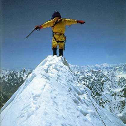
Greg Child on Gasherbrum IV summit June 22, 1986 - Thin Air Encounters In The Himalaya book

Gasherbrum IV First Ascent - Northwest Ridge

Greg Child, Tim Macartney-Snape, and Tom Hargis made the first ascent of the spectacular Northwest Ridge of Gasherbrum IV on June 22, 1986.

Excerpts from Thin Air: Encounters In The Himalaya by Greg Child. The story of Gasherbrum IV starts with getting permission from Pakistan and trekking to Base Camp with the usual porter problems. Child provides a good description of the Pakistan India conflict high in the mountains. The Gasherbrum IV Northwest ridge is "A 1,000 ft icefield capped by a steep 1,000 ft marble and limestone headwall. ... It would be a technical and serious climb right to the top." ... Yes, we all wanted the summit, but the physical and mental pain we had endured and would yet endure was so great that we had to force ourselves onto the mountain." After bivouacking in a snow cave at 7000m, they alternated leading pitches over difficult rock and bivouacked at 7350m.

They couldn't make it the summit the next day, so they dug another ice cave just below the North Summit at 7880m. "As we settle into the cave I feel like a stranded astronaut bedding down for the night on a hostile planet. But no, it’s our own wild and beautiful earth." On June 22, 1986 Greg Child, Tim Macartney-Snape, and Tom Hargis climbed to the North Summit and traversed 450m horizontally to the true Gasherbrum IV Summit, completing the first ascent of the Gasherbrum IV Northwest Ridge. "We functioned as a single being. Now on the summit, that being, drunk with euphoria, felt suddenly as if it had been merged with sky and mountain as well to become a single, elemental entity."
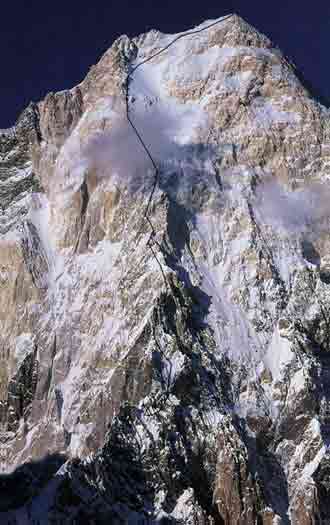
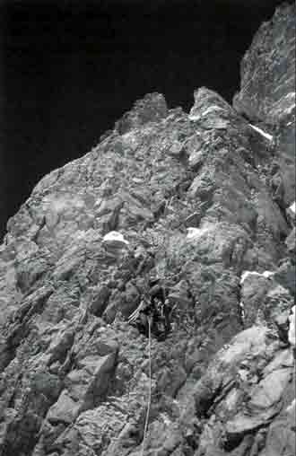
Gasherbrum IV First Ascent West Face Central Spur Route - American Alpine Journal 1998

Gasherbrum IV First Ascent West Face Central Spur - Yoo Huk-jae Climbing Above Camp III - American Alpine Journal 1998

Gasherbrum IV First Ascent West Face Central Spur - Bang Jung-ho Climbing Towards Devils Brow At 7800m - American Alpine Journal 1998

Gasherbrum IV First Ascent West Face Central Spur - Gasherbrum IV Upper West face Showing Footsteps Leading to The Summit July 18, 1997 - American Alpine Journal

Gasherbrum IV First Ascent West Face Central Spur - Yoo Huk-jae At 7900m Descending From Gasherbrum IV Summit July 18, 1997 With Masherbrum In Distance - American Alpine Journal

Gasherbrum IV First Ascent - West Face Central Spur

The first ascent of the Gasherbrum IV West Face Central Spur was completed by Koreans Bang Jung-ho, Kim Tong-kwan and Yoo Huk-jae on July 18, 1995. Jung Jae-Hag in the American Alpine Journal 1998:

The central rib of the west face previously had been attempted by at least six other parties; though none reached the top, seven alpinists were sacrificed to this deadly wall. ... The vertical distance from the snow plateau of Camp I [at 5400m] to the summit was about 2500m, with only two possible places to camp on the entire rib of the west face. ... We had to ascend about 600m on a 70 to 80m degree wall to reach the tiny narrow snow ridge suitable for Camp II. ... On July 12, Yoo Huk-Jae and Byung Ki Choi finally established Camp III at 6800m. ... We had been on the mountain for two months and the season was nearly over. The clock was ticking. We realized that we had only one chance to push to the summit. ... We planned three days to the summit and one day to get back to CIII, which meant three bivouacs.

July 18. The summit day had come. It was a perfect day. ... After climbing 300m on the 70 degree snow-covered wall, we approached a place called 'The Devils' Brow.' Jung-ho took over the lead and advanced another 80m on the icy surface.' ... We could barely proceed up the 60 degree slope of ice and snow with our beaten bodies. ... After advancing 100m, we finally reached the summit ridge. The time was 12:26 p.m.. To the east, a wall formed a perpendicular drop downward; snow covered its top along the summit ridge. We crossed a distance of about 100m along the ridge toward a pinnacle in the south that was tallest on the crest. Hak-Jae ... noticed that six small pinnacles stuck out on the summit ridge of GIV. All of them appeared to be less than 10m high. He easily distinguished the third one as the highest. ...Dong-Kwan arrived at the third pinnacle after traversing 30m along the snow wall right below the ridge. He placed a knife blade and bong-bong and used them to belay the others. At 2:27, they joined him at the belay. Above us, there was a 3m high smooth rock covered by a 2m snow cornice. Hak-Jae realized that we could it [sic] if we demolished the cornice before stepping on it, but it seemed too vulnerable to tackle. The danger of its collapse made the last few metres of climbing meaningless. As sub-leader of the team, he decided that was far as we would go. We took a few pictures and started descending right away. .. In the process of retreating, the CII cornice collapsed. Gung-Yeal was caught by a thin rope; unfortunately, he lost his backpack that contained ten rolls of film, including then summit pictures. After midnight, all members returned to BC.


My Top 5 Memories Of Gasherbrum IV

1. View from Concordia includes K2, Broad Peak, Gasherbrum IV, Gasherbrum II, Baltoro Kangri, Mitre Peak, Paiju Peak, Crystal Peak and Marble Peak. Gasherbrum I becomes visible at Gasherbrum Corner at the junction of the Upper Baltoro Glacier and the Abruzzi Glacier.

2. View from Khoburtse at sunrise includes Paiju Peak, Uli Biaho Tower, Trango Castle, Cathedral and Lobsang Spire.

3. Masherbrum shines at both sunset and sunrise from Goro II camp on the Baltoro Glacier.

4. Trango Nameless Tower and the Great Trango Tower from the Baltoro Glacier on the trek from Paiju to Khoburtse

5. Skardu, situated next to the Indus River, has beautiful lakes and sand dunes