Aconcagua (6962m) Argentina
Aconcagua (6962m) is the highest mountain outside of Asia, and one of the Seven Summits. Although the normal route is non-technical climb, not requiring fixed ropes or ice axe, many climbers underestimate the altitude. My guide told me that only one in three people successfully make it to the summit. I saw one group of about ten Austrians turn back because of high winds, and only five of the fifteen member group that climbed the same day I did made the summit. It was heartbreaking to see some people stay in their tents, some turning back very early on, and one turning back in the crux of the climb, the infamous steep rocky Canaleta.
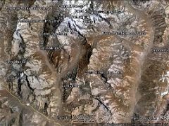
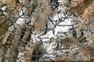
Aconcagua Climbing Route


After driving from Mendoza to Penitentes (2580m) and staying overnight, we drove back to Punta de Vacas (2434m) and trekked for four and a half hours to Pampa de Lenas (2862m). It took five hours to trek to Casa de Piedra (3245m) and then another six hours to Plaza Argentina Base Camp (4200m).
After a rest day at Plaza Argentina with the required visit to the doctor, we climbed in four and a half hours to Camp 1 (5035m), and the next day in three hours to Ameghino Col and Camp 2 (5482m). The next day we climbed in a short two hours to Camp 3 Colera (5980m). We had a rest day at camp 3 Colera because of the high winds.
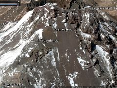
After over two hours of preparation, we left camp 3 Colera at 5:15am and climbed in three hours to Independencia Hut (6390m). After a brief rest, we put on our crampons to climb the snow slope, crossed the Gran Acarreo and climbed in three hours to the Cave (6746m). After a final rest, we left our backpacks at the Cave and climbed up the steep rocky Canaleta, the crux of the climb. We arrived at the large flat Aconcagua summit (6962m) after three hours from the Cave and nine hours from Camp 3 Colera. After just 10 minutes on the summit, we descended in three hours back to the comfort of Colera.
The trail descends down the scree slope in just three hours to the luxuries of Plaza de Mulas (4360m) base camp. The trail then descends to the Horcones River (4000m) and along the rough flat riverbed (3790m) to Confluencia (3428m) in four and a half hours. After a brief rest and snack, the trail descends to Laguna de Horcones and the park exit (2949m) in another one and a half hours.