Mountains Of Travel Photos
Home | Mount Kailash References | Contact 

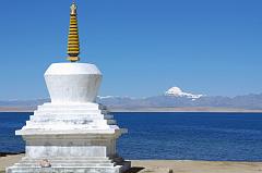
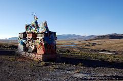
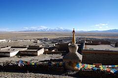
The chorten next to Trugo Gompa has a great view of Mount Kailash across Lake Manasarovar.

The chorten next to Trugo Gompa has a great view of Mount Kailash across Lake Manasarovar. (click to enlarge)


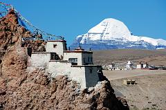
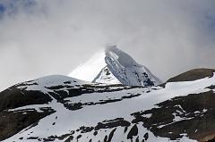
Mount Kailash close up with Chiu Gompa.

Mount Kailash close up with Chiu Gompa. (click to enlarge)


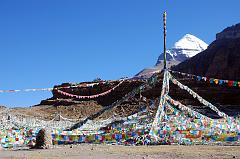
The prayer-flag festooned Tarboche (4750m, 08:27) Pole is replaced each year at the major festival of Saga Dawa, marking the enlightenment of Shakyamuni Buddha. If the pole stands absolutely vertical all is well, but if it leans towards Kailash things are not good, if it leans away, things are even worse. Although we started our trek from Darchen, you can drive here too.

The prayer-flag festooned Tarboche with Mount Kailash behind. (click to enlarge)


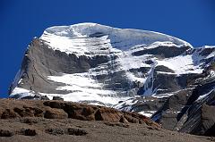
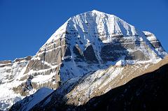
The best view of the West Face of Mount Kailash is from Tamdrin in the Lha Chu Valley.

West Face of Mount Kailash from Tamdrin in the Lha Chu Valley. (click to enlarge)


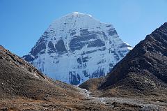
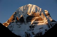
There is a perfect view of Mount Kailash North Face from Dirapuk Gompa.

Mount Kailash North Face from Dirapuk Gompa. (click to enlarge)


There is a perfect view of Mount Kailash North Face from Dirapuk Gompa.

The early morning sun shines on Mount Kailash East and North Faces after trekking 30 minutes from Dirapuk. (click to enlarge)


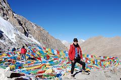
Jerome Ryan on the Dolma La (5653m) at 9:00, just two and a half hours after leaving Dirapuk.

Jerome Ryan on the Dolma La (5653m) at 9:00, just two and a half hours after leaving Dirapuk. (click to enlarge)


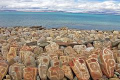
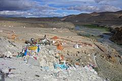
A row of mani rocks shine in one of the brief sunny breaks next to Seralung Gompa on the shores of Lake Manasarovar.

A row of mani rocks shine in one of the brief sunny breaks next to Seralung Gompa on the shores of Lake Manasarovar. (click to enlarge)


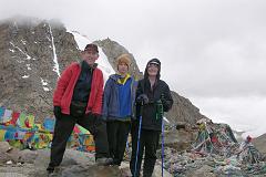
Jerome Ryan, Peter Ryan, and Charlotte Ryan on the Kailash Dolma La (5636m) in 2006

Jerome Ryan, Peter Ryan, and Charlotte Ryan on the Kailash Dolma La (5636m) in 2006 (click to enlarge)


There is a perfect view of Mount Kailash North Face from Dirapuk Gompa.

Sunrise on Mount Kailash North Face is just perfect from Dirapuk. (click to enlarge)


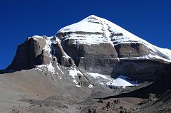
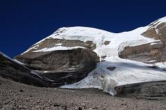
Mount Kailash South Face shines beautifully in the mid-morning sun from the Inner Kora (09:13). At the bottom of the face is the Atma Linga, a pyramidal ice formation.

Mount Kailash South Face shines beautifully in the mid-morning sun from the Inner Kora. (click to enlarge)


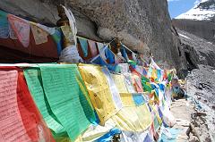
I did a full circle from where I stood to admire the panorama (11:36). Prayer flags drape some of the 13 Golden Chortens on Mount Kailash South Face in Saptarishi Cave. This view leads to the Nandi Pass with just a bit of Nandi on the right.

Prayer flags drape some of the 13 Golden Chortens on Mount Kailash South Face in Saptarishi Cave. This view leads to the Nandi Pass with just a bit of Nandi on the right. (click to enlarge)


The South face of Mount Kailash once again comes into perfect view as we descend from the Nandi pass towards the Eastern Valley (13:08).

The South face of Mount Kailash once again comes into perfect view as we descend from the Nandi pass towards the Eastern Valley (13:08). (click to enlarge)


About 30 minutes from the end of the descent from the Dolma La, a valley comes down from the Khando Sanglam La to join the main trail. This valley provides the only glimpse of the Eastern or crystal Face of Mount Kailash. The Kailash South Face is to the left and the North Face is to the right.

Kailash East Face with the South Face to the left and the North Face to the right. (click to enlarge)


Chortens dot the hills above Old Zhongba in Tibet, here with a view towards the west at sunset

Chortens dot the hills above Old Zhongba in Tibet, here with a view towards the west at sunset (click to enlarge)


After the hot springs the trail climbs past a cremation area consecrated to Yeshe Tsogyal, and then reaches a miniature version of Kailash's Dölma La, marked with mani stones, prayer flags and a large collection of yak horns and skulls. To the left is the end of a recently constructed over 200m long mani wall, which points to the northeast directly towards Mount Kailas. The wall was the end result of a demon firing an arrow at the guru. He stopped the arrow's flight and transformed it into this wall.

The kora at Tirthapuri has a miniature version of Kailash's Dölma La, marked with mani stones, prayer flags and a large collection of yak horns and skulls. (click to enlarge)


I climb up above the chorten and mani wall on the northern edge of Darchen for a view of the village and the Barkha Plain stretching to Gurla Mandhata.

I climb up above the chorten and mani wall on the northern edge of Darchen for a view of the village and the Barkha Plain stretching to Gurla Mandhata. (click to enlarge)


Peter Ryan and Jerome Ryan rocked to an Ipod as Sadim and crew fixed the Land cruiser near Peiko Tso. Cool!

Peter Ryan and Jerome Ryan rocked to an Ipod as Sadim and crew fixed the Land cruiser near Peiko Tso. Cool! (click to enlarge)

Updated: February 2012. Click on an image to see the FULL size with a caption.


Mount Kailash / Kailas 6714m

At the centre of the earth, there stands a great mountain,

Lord of Snows, majestic, rooted in the sea,

its summit wreathed in clouds

a measuring rod for all creation

- Kalidasa, Indian poet and dramatist (4C)

Above all the sacred mountains of the world the fame of Kailas has spread and inspired human beings since times immemorial. There is no other mountain comparable to Kailas, because it forms the hub of the two most important ancient civilizations of the world, whose traditions remained intact for thousands of years: India and China. To Hindus and Buddhists alike, Kailas is the centre of the universe. Thus to Hindus Kailas is the seat of Shiva, while to Buddhists it represents a gigantic mandala of Dhyani-Buddhas and Bodhisattvas, as described in the famous Demchog (Chakrasamvara) Tantra, the ‘Mandala of Highest bliss’. – Lama Anagarika Govinda: The Way of the White Clouds.

Mount Kailash, at 6714m, is not the highest of the mountains in the region, but with its hulking shape, like the handle of a millstone according to Tibetans, and its year-round snowcapped peak, it stands apart from the pack. Its four sheer walls match the cardinal points of the compass, and its southern face is famously marked by a long vertical cleft punctuated halfway down by a horizontal line of rock strata. This scarring resembles a swastika, a Buddhist symbol of spiritual strength, and is a feature that has contributed to Kailash’s mythical status. The mountain is known in Tibetan as Kang Rinpoche, or ‘Precious Jewel of Snow’. – Lonely Planet.

Kailas forms the spire of the ‘Roof of the World’ and radiating from it, like spokes from the hub of a wheel, a number of mighty rivers take their course towards the east, the west, the north-west, and the south. These rivers are the Brahmaputra (Yarlung Tsangpo), the Indus, the Sutlej, and the Karnali (feeds into the Ganges). All these rivers have their source in the Kailas-Manasarovar region, which forms the highest tier of the Tibetan plateau. This is especially apparent in the case of the Indus and the Brahmaputra, which, like two gigantic arms emerging from the Kailas-Manasarovar region, embrace the entirety of the Himalayas and the whole of the Indian subcontinent, the Indus flowing into the Arabian Sea in the west, the Brahmaputra into the Bay of Bengal in the east. – Lama Anagarika Govinda: The Way of the White Clouds.

A single kora (circuit) of the mountain is said to erase the sins of a lifetime; ten the sins of an age, while 108 ensure Nirvana. However, these numbers aren’t meant to be taken literally. To gain Enlightenment, after one kora or a thousand your mind must be in touch with the gods and holy things. Most Tibetans prefer to walk about Kailash in a single day.

The Tibetan word for pilgrimage, né-kor, means to circle around a sacred site and, throughout the Buddhist world – from the Jokhang in Lhasa to revered features of the landscape – pilgrims seek religious merit by performing koras around places or objects that they consider holy. Guided by an intuition that the sacred cannot be approached in a straight line, still less by linear thought, pilgrims emulate the path of the sun and circumambulate in a clockwise direction, beginning as we had from the east. – Ian Baker: The Heart of the World.

At the southern foot of Kailas there are two sacred lakes, Manasarovar and Rakastal, of which the former is shaped like the sun and represents the forces of light, while the other is curved like the crescent moon and represents the hidden forces of the night. ‘Manas’ means mind or consciousness: the seat of the forces of cognition, of light, of enlightenment. ‘Rakas’ means demon, so Rakastal means ‘Lake of the Demons’. – Lama Anagarika Govinda: The Way of the White Clouds.


My New Youtube Videos - Mount Kailash Outer and Inner Koras; traveling to Mount Kailash; driving the Lake Manasarovar kora


My Top 6 Memories Of Kailash

1. Kailash Inner Kora - trek to the 13 Golden Chortens in Saptarishi Cave in the South Face of Mount Kailash and complete the Nandi Parikrama

2. Kailash Kora - splendid trek with spectacular scenery, a 5630m high mountain pass, and admiring the intense faith of the Buddhist pilgrims

3. Kailash North Face - full view of Kailash in all its grandeur, nestled between two hills and above a glacier. Especially beautiful at sunset.

4. Kailash South Face - the first view of Kailash is breath-taking, with a conical snow summit and a great swastika-like central scar.

5. Tirthapuri - a short 1-hour kora with hot springs, self-manifesting chortens, white and red limestone terraces, set next to the Sutlej River.

6. Lake Manasarovar Kora - drove around the broad and blue holy lake with several stops at gompas, with Chiu Gompa the most picturesque